The Parks of the Colorado Plateau – A Circular Route from Las Vegas
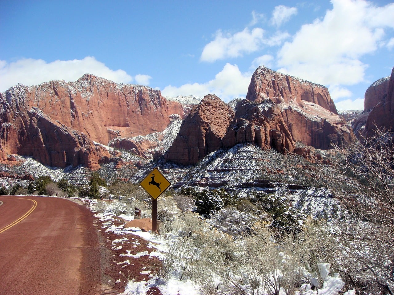
As the Colorado River descends from the western slopes of the Rocky Mountains, it carves its way through a vast desert area known as the Colorado Plateau, recognized in the USA as the Wild West. This elevated plateau is characterized by soft Navajo sandstone, layered over older and harder geological formations. The carving of the Colorado River (and its various tributaries) creates a unique geological formation of canyons.

- Along the river's path are some of the most famous canyons in the USA, the most renowned being the Grand Canyon
- Besides the canyons, the desert landscape features magnificent formations of weathered buttes, mesas, arches, and pillars
- On a road trip route starting from Las Vegas, you can reach all these geological wonders located in popular nature reserves and national parks
The circular route east of Las Vegas includes the following parks:
- The Valley of Fire State Park
- Hoover Dam
- Grand Canyon National Park
- Monument Valley
- Arches National Park
- Canyonlands National Park
- Capitol Reef National Park
- Grand Staircase-Escalante National Monument
- Kodachrome Basin State Park
- Bryce Canyon National Park
- Dixie National Forest
- Zion National Park
- Red Cliffs National Conservation Area
- Coyote Buttes
- Glen Canyon
How to explore the national parks of the Colorado Plateau desert?
Traveling through the national parks and various nature reserves of the Colorado River Basin mainly relies on driving, stopping at scenic viewpoints, and taking hiking trails. Many of the parks and nature reserves are accessible by paved road, but some require a four-wheel drive vehicle.
How many days are needed for a trip to the national parks of the Colorado Plateau?
For the full itinerary of the unique Colorado River Basin road trip, it is recommended to allocate at least two weeks, including a day in Las Vegas and generally a full day for each national park (Grand Canyon, Arches, Canyonlands, Bryce Canyon, and Zion). Some parks require a half-day visit, such as Monument Valley, the Coyote Buttes, Capitol Reef, etc., and some you can simply drive through with a short stop. Keep in mind the relatively long travel times between parks.
What are the national parks of the Colorado Plateau?
The national parks of the Colorado Plateau offer a breathtaking experience with various geological formations in the desert made of Navajo sandstone, across the Colorado River Basin area. The mighty river drains the western slopes of the Rocky Mountains and begins at Rocky Mountain National Park in the state of Colorado.
- Along its flow, the Colorado River creates a series of massive canyons, the largest and most famous of which is the Grand Canyon. However, Canyonlands and Glen Canyon (now an artificial lake) are also gigantic canyons carved by the river into the soft sandstone.
- Aside from the massive canyons, the Colorado Plateau, in southern Utah and northern Arizona, is bursting with an unbelievable variety of stunning geological formations. From arches and rock pillars, to massive buttes and mesas, all sculpted by the desert nature – the drying sun, crumbling winds, and river waters seeping deep below the plateau.
- Throughout the basin, there is an endless array of famous national parks, each with its own unique geological formations.
- The Grand Canyon is a single massive canyon; the Canyonlands are two intersecting canyons (the confluence of the Green River with the Colorado River); Glen Canyon is a photogenic artificial lake on a flooded canyon area; Zion Park features desert nature with riverine gullies; Bryce Canyon boasts a stunning cluster of Hoodoo formations (dense rock pillars); Arches National Park is a hub of arches, and Monument Valley is an iconic American landmark with awe-inspiring buttes.
- Throughout the route, there are also smaller parks like Capitol Reef, which is a layer of rock that has uplifted, and the Grand Staircase-Escalante composed of four cliffs creating a staircase appearance on the horizon.
Map of the National Parks of the Colorado Plateau
How to Get to the Parks of Southern Utah?
To fully experience the Colorado Plateau National Parks route, a car is a must, preferably a 4X4 vehicle for those dirt roads. Many parks and nature reserves are only accessible via these dirt roads, which are often drivable with regular cars too. The roads connecting the parks and reserves are typical of the American West—fast and excellent highways that provide dreamy scenic drives on their own.
Flying into the area depends on where you start your journey. Major airports can be found in Las Vegas, Salt Lake City, Phoenix, and Denver. Along the route, there are also smaller airports, like the Grand Canyon Airport and an airport near Moab. These smaller airports are generally accessible by small aircraft from Las Vegas or Salt Lake City, and transfers are available to reach them.
Click here for all the information on renting a car in the Wild West of the United States…
When to visit the parks of Southern Utah?
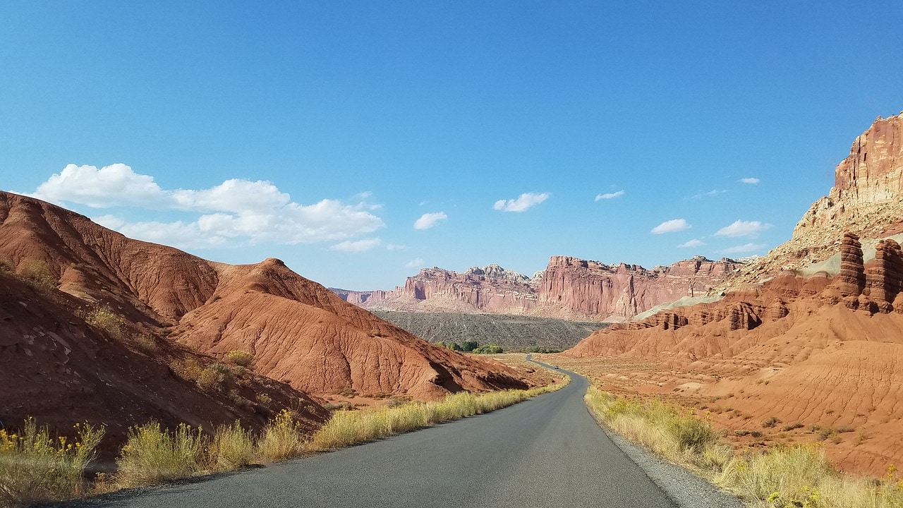
The weather in the parks and nature reserves of the Colorado River Basin is a crucial factor for a trip. It's a vast area with an extreme continental climate at high altitude, featuring desert characteristics, and in some places, extremely harsh conditions. Much of the area includes extreme heat and dryness during the summer days and cold, snowy weather in the winter days.
Precipitation hardly affects a trip in the Colorado River Basin, as rain and snow are relatively rare.
- The perfect season for a road trip is spring, from April to June. In spring, the weather is wonderfully pleasant, not too hot nor too cold (it can sometimes be chilly to really cold and also can be warm). The rivers in the canyons are particularly raging with the snow melt waters and the long hours of sunshine allow for a longer hike until the afternoon.
- Autumn is also great for traveling. In the months of October and November, the weather is moderate, no longer too hot and not yet freezing. Frost and snow start towards the end of November, but even at temperatures around freezing in the evenings, you can enjoy hiking in the area.
- The summer season in the desert section is very harsh. The weather is extremely hot and very dry, with average temperatures over 35 degrees Celsius. From mid-July to mid-September, there can be days of extreme heat. On such days, access to areas in the park is limited, and it's better to stay on an air-conditioned driving tour.
- The winter in the parks can be just as tough as the summer. The temperature fluctuation in winter is absolutely insane, with options for deeply sub-zero days mixed with really nice sunny days that can hit twenty degrees. If you find yourself on a beautiful winter day, the parks are a dream; if it's freezing, then it's tough to explore them, including snow and ice accumulations.
How to Plan a Travel Route in the National Parks of the Colorado Plateau?
The travel route in the Colorado River drainage basin in Utah and Arizona is circular. It can be started in the major cities around the drainage basin, like Denver or Salt Lake City, but ideally, start it in Las Vegas.
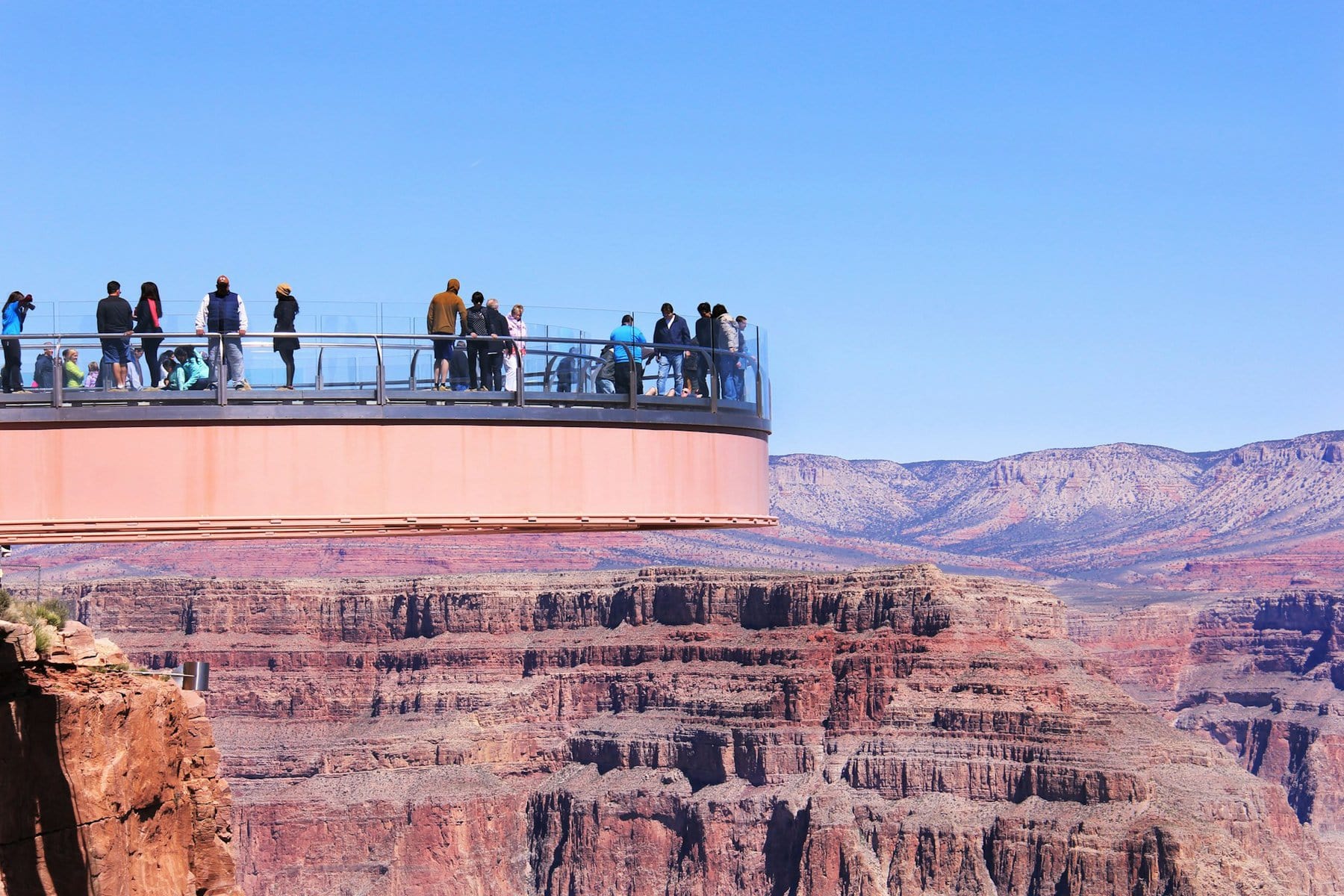
- The trip from Las Vegas heads towards the Hoover Dam and the western part of the Grand Canyon, where you'll find Eagle Point and the top attraction, the Skywalk, a transparent observation deck over the canyon.
- From there, continue to the Grand Canyon Village for a tour of the Grand Canyon National Park.
- From the Grand Canyon, travel to the stunning Monument Valley.
- The town of Moab is the next stop on the trip, at the highest part of the Colorado River route. Near the town are two national parks – Arches and Canyonlands, each deserving a full day of exploration.
- From Moab, continue to Capitol Reef National Park and then onwards to the Grand Staircase-Escalante National Monument.
- On the road between Escalante and Bryce Canyon National Park, it's worth a short stop at Kodachrome Basin State Park.
- Bryce Canyon requires at least a day's hike, and from there continue to Zion National Park. It's recommended to drive between the parks via the scenic route of the Dixie National Forest.
- After exploring Zion National Park, you can visit the Red Cliffs Reserve above nearby Washington.
- From Washington, you can head back to Las Vegas or venture east for another day or two of travel, including the breathtaking scenery of the Coyote Buttes and relaxing by the artificial lake at Glen Canyon.
Click here for professional trip planning and consultation in the Wild West…
Las Vegas
Las Vegas is a legendary tourist brand in the southern part of Nevada. The city that rose from the desert is now the number one fun and entertainment destination in the United States. Along the Las Vegas Strip, there's an unbelievable concentration of hotels and resorts that primarily combine accommodation with huge casinos. Beyond the rooms and neon halls that operate 24/7, in the hotels and nearby, there's a vast array of attractions of all types and kinds.
Click here for all the information about traveling to Las Vegas – the Sin City…

The Las Vegas Strip
The Las Vegas Strip is the grand central of tourism and leisure. It's the most intense place in the world for gambling and a generic name for an escapade with a hint of exciting nightlife. Gambling formed the foundation of the city's development as a tourist destination, but the Strip's hotels and resorts have evolved significantly since the lively days of Bugsy Siegel and Sin City.
Today, the hotels offer rare vacation options with pools, spa facilities, indoor malls within casinos, and a massive variety of entertainment choices. The Strip's hotels are the freest place on earth with options for drinks, dining, buffets, and everything imaginable for 24/7 fun.
Click here for all the information on the iconic themed hotels on the Las Vegas Strip…
Click here to find a hotel for staying, vacationing, and having fun on the Las Vegas Strip…
Valley of Fire State Park
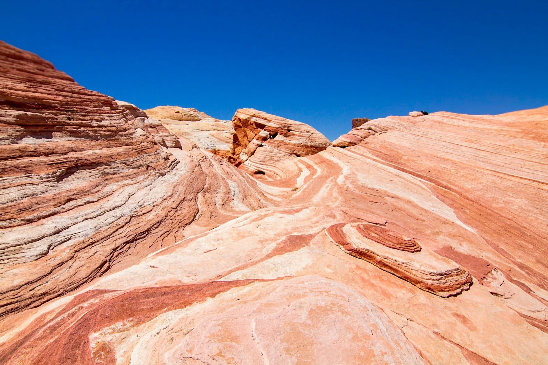
The Valley of Fire is a popular desert hiking destination east of Las Vegas, located in the northern part of Lake Mead. The park features unique geological formations made of red sandstone. It's accessible from Las Vegas by car, with its center being Atlatl Rock Campground. Another spot in the park is Arch Rock Campground. Near these campgrounds, you'll find many of the park's highlights like the popular Atlatl Rock which you can climb, Arch Rock, Piano Rock, and Fire Cave.
Click here for a guided hike of the Valley of Fire attractions…
East of there is the Valley of Fire Visitor Center, from which you can head north to the spectacular geological expanses in the direction of The White Domes Trail.
Click here for all the information about visiting the national park…
Hoover Dam
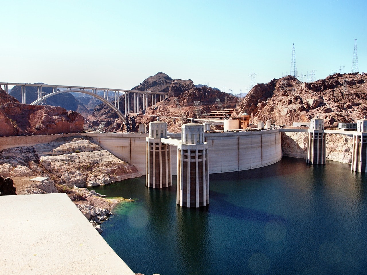
The massive arch dam is located just a forty-minute drive southeast of the Las Vegas Strip. It's adjacent to Boulder City, which was originally built to house the dam's builders. This monumental arch dam was completed in 1935 and has colossal significance in the development of nearby Las Vegas.
Click here for a round-trip day tour from Vegas to Hoover Dam + Lunch…
The dam blocks the waters of the Colorado River, creating the artificial Lake Mead. The construction of the dam was part of the U.S. government's initiatives during the Great Depression to provide employment and expand the American empire. It was named after President Herbert C. Hoover, the 31st President of the USA, remembered as the president of the stock market crash.
The height of the Hoover Dam is about 222 meters, and its length is about 340 meters. It may not be one of the largest dams in the USA, but it's probably the most famous. The dam provides electricity for the crazy consumption of the nearby lighting empire in Vegas, as well as for the rest of Nevada, Arizona, and parts of California.
Click here for a half-day tour to Hoover Dam from the Strip…
Over the years, Hoover Dam has become a popular tourist destination. You can reach the dam via the I-11 highway heading south from Vegas. You can drive your car over the dam or park nearby and walk along sidewalks on both sides of the road. Close to the dam are several viewpoints where parking is available. The visit to the dam is very organized, with a visitors center, souvenir shop, and more.
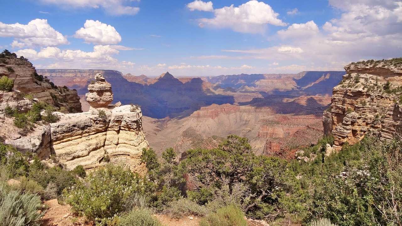
Grand Canyon National Park
The Grand Canyon National Park is one of the most famous icons of the stunning national parks in the USA. In western Arizona, on the Rocky Mountains plateau at an elevation of 2000 meters, the Colorado River carves into the soft desert rock, creating a chasm nearly two kilometers deep above the surface.
The vast chasm stretches nearly 450 kilometers and its western section lies not far from Las Vegas. The Grand Canyon Village is the main hub of the park, with trails, roads, and everything needed for spectacular scenic views. Far from there, in the western chasm, lies the crazy attraction of the Skywalk at Eagle Point, an observation deck with a glass floor right above the canyon. The Skywalk is one of the most attractive day trip destinations from Las Vegas.
Click here for all the information on touring the Grand Canyon National Park in Northern Arizona…
How to tour the Grand Canyon?
The Grand Canyon trip is divided into two:
- South Rim, where the Grand Canyon Village is located – This is the official tour area of the national park. It features hiking trails along the edge of the abyss, a challenging hiking trail down to the Colorado River, lodge hotels, stores, organized scenic lookouts, and scenic driving roads.
- Eagle Point in the West Rim – A small site with one stunning attraction – the Skywalk. This is the tour area near Las Vegas, and it provides the most popular taste of the canyon for those who don't want to make the long drive to the Grand Canyon Village.
What is the Grand Canyon National Park?
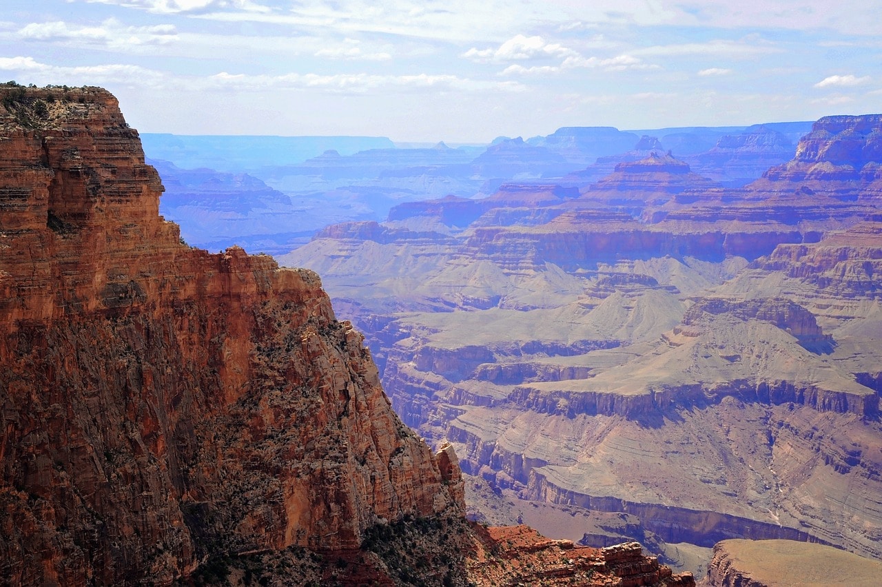
The Grand Canyon National Park is one of the most stunning and mind-blowing natural wonders in the desert region of the USA. It is the largest canyon in the world, both in depth and length. The canyon was formed by the erosion of the sandy terrain by the intense flow of the Colorado River or Río Colorado – its name in Spanish, meaning the red river.
- The river flows from the high valleys of the ridges west of Denver, Colorado, and has a vast drainage basin throughout the southwestern part of the USA.
- It continues into Arizona and Nevada, where it twists through the desert landscape, carving out deep canyons and gorges, including the Grand Canyon.
- The river flows through the Hoover Dam near Las Vegas and heads south along the eastern border of California until it empties into the Gulf of California in Mexico.
Click here for a day trip from Las Vegas to Hoover Dam and the Grand Canyon…
The Grand Canyon of the Colorado River, or the Grand Canyon, was declared a national park in 1919. The park covers an area of nearly 5,000 square kilometers (about a quarter of the size of New Jersey).
- The canyon is approximately 446 kilometers long (more than the distance from Metula to Eilat), its width reaches up to 18 kilometers, and its stunning depth is almost 2,000 meters.
- Between the two sides of the canyon, there is a significant elevation difference of 300 meters in favor of the north side, creating a climate difference between the two sides. The climate on the north side is nearly subtropical, including precipitation.
- The South Rim of the canyon (only a few kilometers from the north) is arid and desert-like.
- The eastern part of the South Rim, north of the town of Williams in Arizona, is the most developed area in the park and the main tourist destination of the Grand Canyon.
- The main accessible viewpoint of the Grand Canyon is from the Grand Canyon Village and its surroundings, the village that is considered the visitor center of the South Rim.
- The height of the upper rim cliffs is around 2000 meters, and the river's flow is about 760 meters above sea level. As the flow is mountainous, the river's force still erodes the soft rock, digging deeper and further deepening the canyon.
A secondary travel area is Grand Canyon West, which is closer to Las Vegas, featuring the transparent observation deck Skywalk, which has become one of the most popular tourist attractions in the park.
Click here for a day trip from Las Vegas to the western part of the Grand Canyon…
Monument Valley
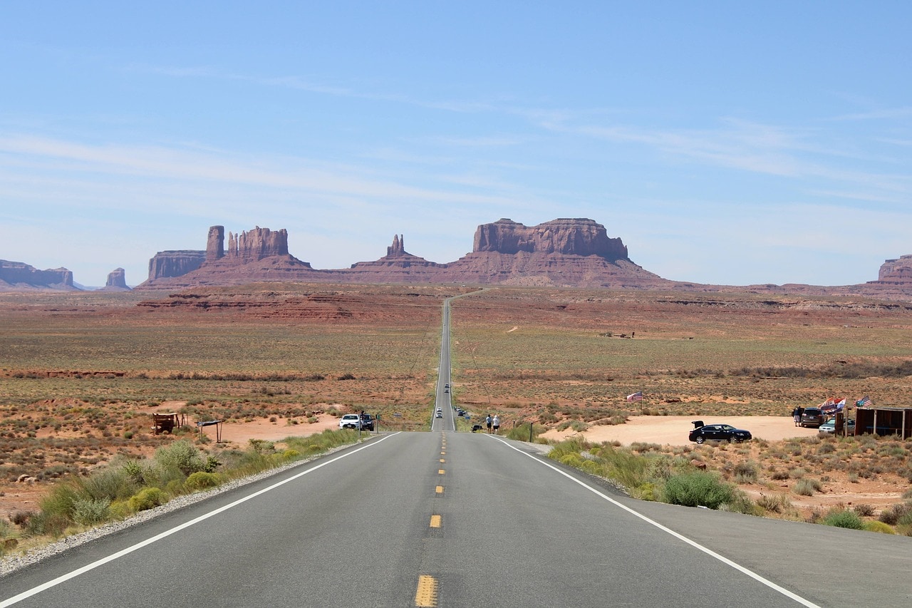
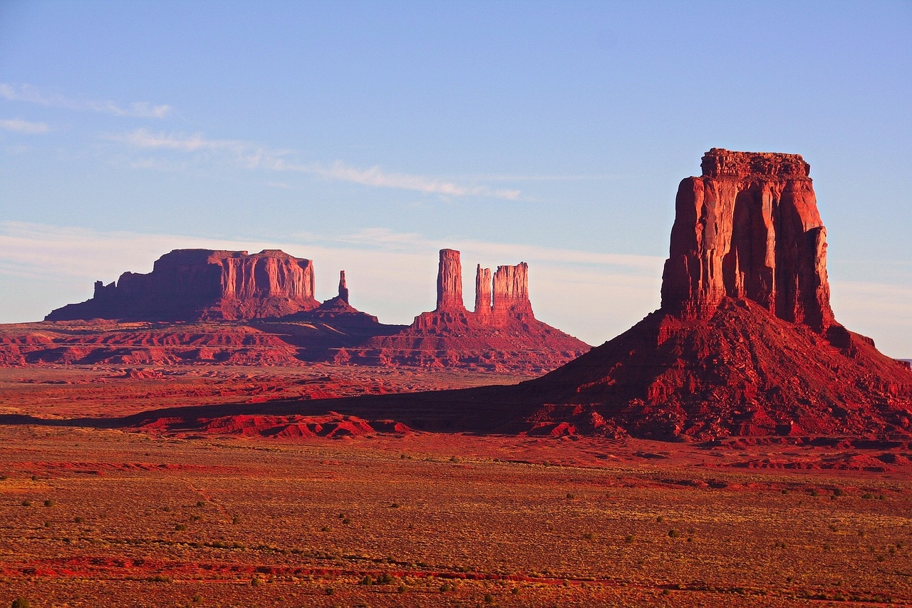
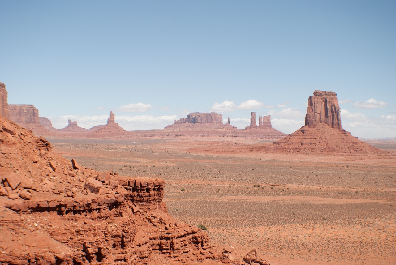
Monument Valley, at the heart of the Navajo Nation's independent territory, is one of the most iconic travel destinations in the western United States. The iconic valley is located a two and a half hour drive from Grand Canyon Village. The valley, rare in its beauty, has become a part of American culture mainly due to its appearance in a wide variety of films and westerns. The valley symbolizes the Wild West more than anything else. It comprises sections of mesa formations and numerous buttes, rising between 200 to 350 meters above the valley floor.
The unique geological formations were shaped by wind and sun erosion over millions of years. The East Mitten Butte and West Mitten Butte are the stars of the park, showcasing breathtaking geological formations that stand out above the open valley.
Click here for the complete guide to touring the Mittens and the mesas of Monument Valley…
How do you explore Monument Valley?
The trip to Monument Valley is primarily based on driving over the dirt trails of the valley. There are no hiking trails in the valley; it's all about driving and stopping at viewpoints. Since there's a relatively flat area beneath the mesas (flat-topped mountains) and the buttes (the park's towering rock columns), you can stop at many makeshift parking spots along the road or in parking lots and walk in the valley areas towards the mountains. Climbing the mountains isn't possible, except at a few spots where it's allowed (these points will be crowded with visitors, so you can't miss them).
The drive to Monument Valley is long and tiring, so it's definitely worth finding accommodation near the valley.
Click here to check availability and prices for roadside hotels near Monument Valley…
What is Monument Valley?
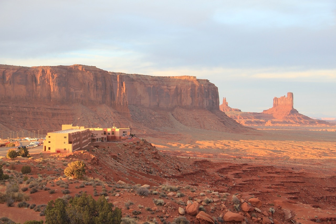
Monument Valley is one of the most iconic natural landscapes in the USA. The weathered buttes, often simply called Buttes, are stars of many American productions from Westerns to popular Hollywood films. This stunning primitive landscape represents the American West and desert area more than anything else.
- The valley is located in the heart of the Navajo Nation, a semi-autonomous territory of the large Native tribe, in the area known as Four Corners where the borders of Arizona in the southwest, Utah in the northwest, Colorado in the northeast, and New Mexico in the southeast connect.
- In the vast and desert terrain of the Navajo Nation live around 160,000 people in scattered settlements, in an area three times the size of New Jersey.
- Monument Valley lies in the center of the Colorado Plateau on the border between Utah and Arizona.
- North of the valley runs Highway 163, which connects Moab, Utah, the city of the legendary national parks of the Colorado River to the north (Arches and Canyonlands), with the route heading west toward the Grand Canyon National Park
- On the high and flat plateau, the stunning buttes stand out, formed by differences in rock hardness
- The wind and sun erosion over hundreds of millions of years created these unique buttes, towering hundreds of meters above the valley floor
- The peaks of the mesas and buttes rise up to 350 meters above the valley floor. The valley itself lies on a plateau about one and a half kilometers above sea level

Arches National Park
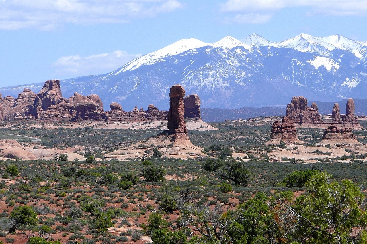
Arches National Park is one of the most beautiful and unique national parks in the Colorado Plateau. Located on the western slopes of the Rocky Mountains, next to the town of Moab in Utah, at the starting point of the Great Rain Shadow Desert, the park is characterized by stunning geological arches.
The park boasts over 2,000 arches, some of which have become stars, including the widest natural arch in the world. Besides arches, the national park features hiking trails bustling with visitors, breathtaking viewpoints towards the Rocky Mountains, and utterly surreal sites and attractions against the backdrop of table mountains, button mountains, and magnificent rock pillars.
Click here for all the information about a trip to Arches National Park…
How to explore Arches National Park?
The trip to Arches National Park is based on driving stops at various viewpoints near stunning arches, button mountains, and table mountains. At these stops, there are also trailheads leading towards the attractions. The national park has a limited number of hiking trails, most of them very popular, and some quite strenuous, so it's important to know beforehand the nature of the trail you're heading on. The trails are particularly inviting in the fall and spring. In summer and winter, the main focus of the trip is the air-conditioned car, as the weather often doesn't allow for long outdoor hikes.
What is Arches National Park?
Arches National Park, or the Arch Park, excels with its stunning geology featuring a great number of magnificent natural stone arches, in what is considered the largest concentration of arches in the world.
- The park boasts over 2,000 stone arches in various sizes, many of which have become its main attractions, including the world's longest natural arch, the Landscape Arch, and the Delicate Arch, which has become the state symbol of Utah.
- The park is located in the northern part of the town of Moab in eastern Utah, not far from Canyonlands National Park to the southwest of the city. The Arches area was declared a national park in 1971.
- The park is situated on a high mountainous plateau north of the Colorado River's path, in the more eastern part of the Colorado Plateau.
Canyonlands National Park
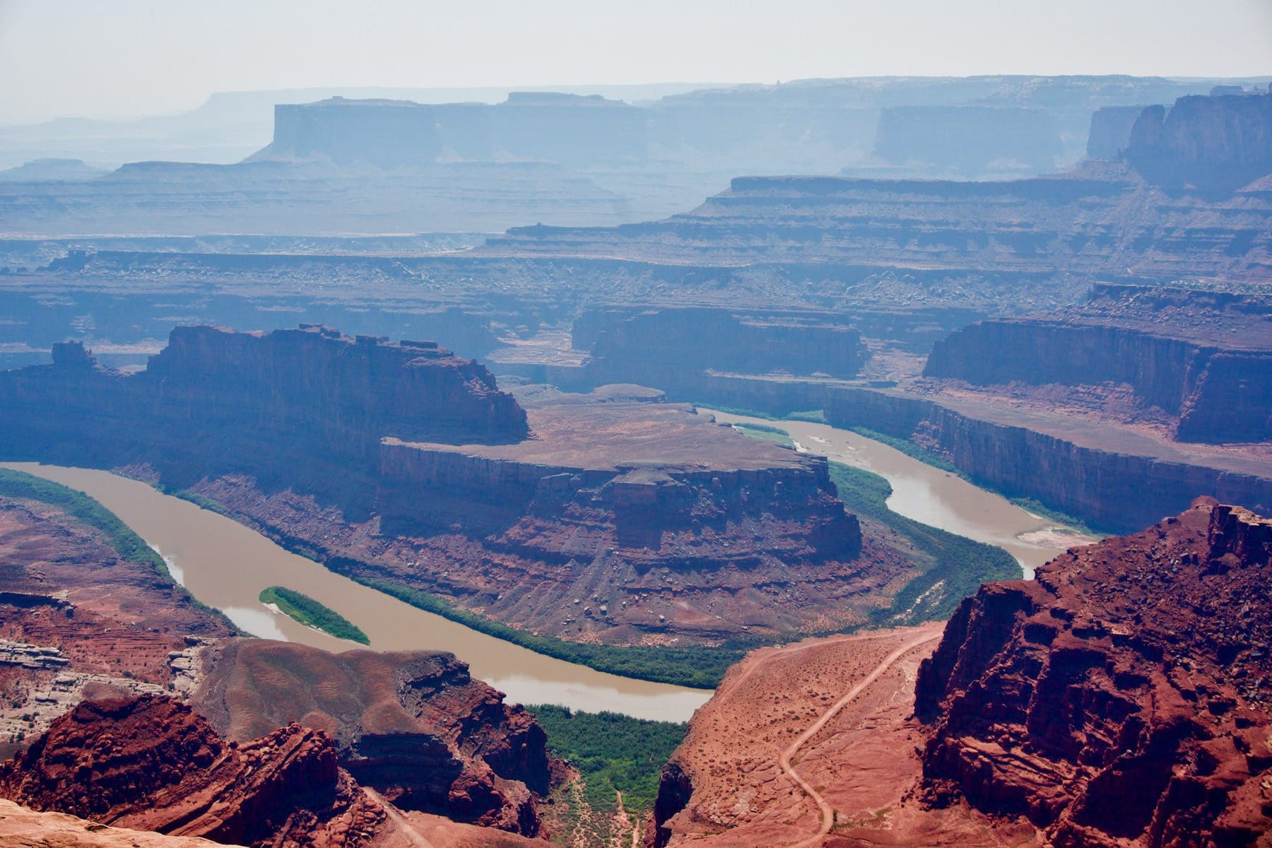
Canyonlands National Park is located on the Island in the Sky, the high desert mesa carved on all sides by the confluence of the Green River Canyon with the Colorado River Canyon. At the edge of the abyss, there are a series of viewpoints accessible by car, offering a rare panoramic view of the gigantic formation of the two canyons.
Along the way, there are additional stunning geological features like arches, tabletop mountains, and even a large crater created by a meteor crash. The park is a fun spot for family outings with a private car and kids, but it's also a haven for off-road enthusiasts, whether on bicycles or 4×4 vehicles.
Click here for all the information about touring Canyonlands National Park in Utah…
How do you explore Canyonlands National Park?
The tour of Arches National Park mostly involves driving with stops at various lookout points over the cliffs of the Green River and Colorado River. At the stopping points, there are also trailheads for short or slightly longer hiking trails leading to various attractions, whether geological features or unique viewpoints right over the edge of the cliffs.
The national park has a limited number of hiking trails, most of which are very popular and crowded with visitors, while some are more challenging. Longer trails that take you away from the car are better suited for spring and fall hikes when the weather is mild. In the summer, hiking outside the car is tough, with extreme temperatures, and in winter, it can be freezing.

What is Canyonlands National Park?
Canyonlands National Park spans the eroded desert landscape of the Green and Colorado River canyons. The park is a short drive west of Moab and not far from Arches National Park, a bit to the east.
- Just like its sibling (and much like many parks in the Colorado Plateau desert region), this park showcases stunning geological erosion, including mesas, buttes, spires, arches, and of course, most importantly – the two massive canyons of the Green River and the Colorado River.
- The developed part of the park is located on the plateau known as Island in the Sky. The plateau sits above the intersecting canyons of the Green River and the Colorado River. Two main roads run along the plateau, leading to all available viewpoints and geological attractions (there are many attractions that can only be seen from a distance).
- Apart from the canyons, all geological formations originate from various folds of prehistoric layers combined with softer rocks that have eroded, and harder rocks that remain exposed in a stunning vertical geological formation.
- Canyonlands has it all – arches, buttes, mesas, and of course – two giant canyons, one carved by the Colorado River (with the Grand Canyon downstream) and its tributary, the Green River. Both rivers carve massive canyons into the soft Navajo sandstone, revealing ancient soil layers.
Capitol Reef National Park
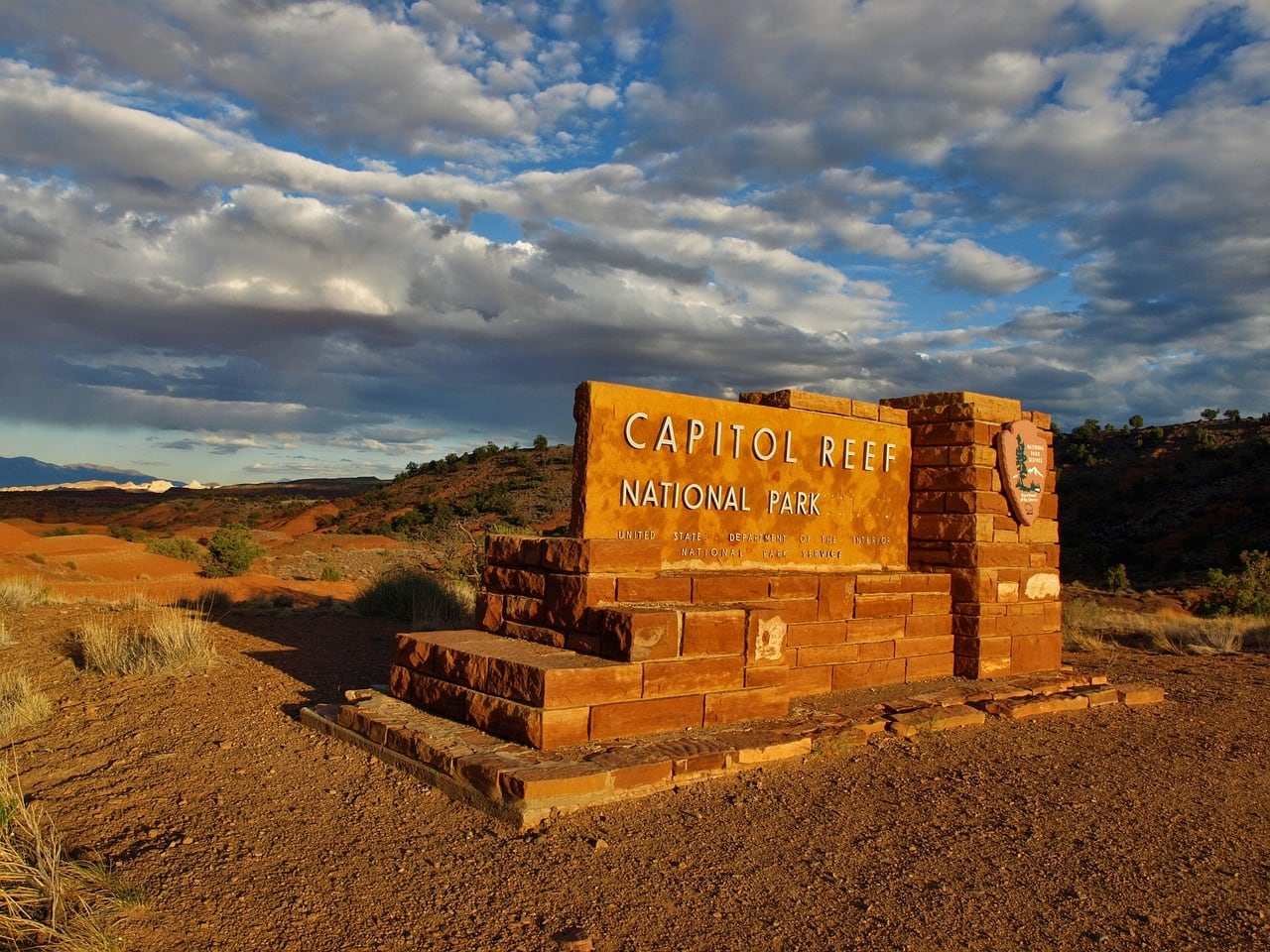
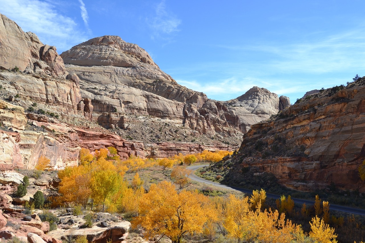
Capitol Reef National Park is located just over a two-hour drive from the town of Moab, home base for Arches and Canyonlands National Parks. The park was designated as a national park in 1971 to prevent any development in the area and to preserve the unique Waterpocket Fold. This geological fold is an enormous white wall stretching nearly 160 kilometers.
The folding starts north of Highway 24, which crosses it and stretches almost up to the Glen Canyon. Most of the fold is an utterly inaccessible primal nature, and anyone hiking there must be a professional hiker and obtain all necessary permits from park authorities. The main standard tour in the park is around the visitor center in Fruita, located on Highway 24.
Capitol Reef National Park Visitor Center Area
The park's visitor center is located in the village of Fruita, on Highway 24, north of the fold. Around the visitor center, you can experience the Waterpocket Fold and several local attractions such as the Hickman Natural Bridge and ancient petroglyphs carved into the rock cliffs. Near the visitor center is also the Gifford Homestead, built in 1908. Today, the homestead operates as a museum depicting Mormon settlement in the area at the end of the 19th century.
Above the visitor center rises the stunning Navajo Dome, and a bit to the east is Capitol Dome, after which the park is named. This dome reminded the Mormon gold miners passing through during the westward expansion of the Capitol building in Washington.
Grand Staircase-Escalante National Monument
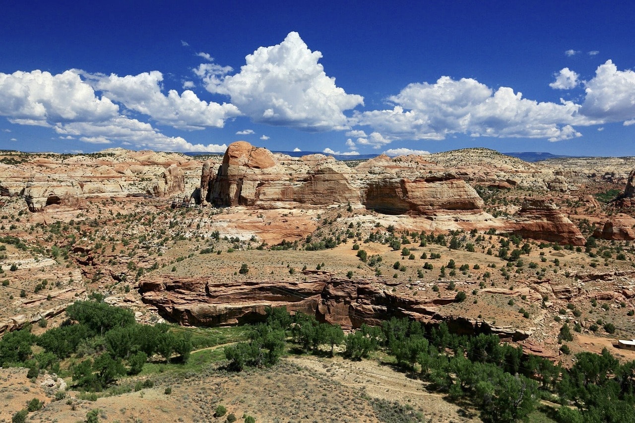
From Fruita, the center of Capitol Reef National Park, head south on Highway 12 to the town of Escalante, about an hour and a half drive. The park preserves the Grand Staircase, an ancient rock formation with four cliffs that look like steps from afar.
The National Monument is a tough, almost inaccessible desert nature reserve. The tour includes heading south on a dirt road from Escalante towards Devils Garden. It's a fairly rough dirt road, better traveled with a four-wheel-drive vehicle; the drive takes about half an hour. The road runs along the eastern slopes of the Grand Staircase.
Kodachrome Basin State Park
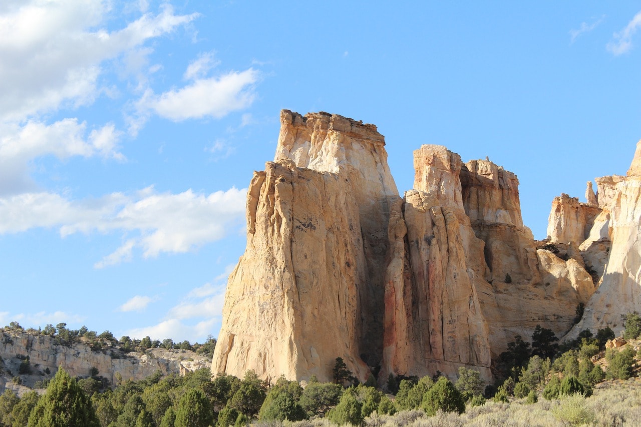
A fifty-minute drive west of Escalante lies the small state park of Kodachrome Basin. This unique park boasts 67 rock columns scattered across a dry channel basin. The base for exploring the basin is the Kodachrome Basin State Park Visitor Center, located a fifteen-minute drive from the town of Cannonville on Highway 12. The park tour involves driving on the scenic road that continues from the visitor center and ends at the trailhead of the Eagle's View Trail.
Bryce Canyon National Park
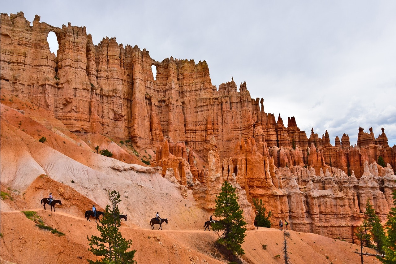
Bryce Canyon National Park in southern Utah is one of the United States' most unique geological expanses. The park is a 20-minute drive along Highway 12 from the town of Cannonville. This famous park features wide canyons formed by the erosion of soft sandstone, with the unique Hoodoo formations that have become the park's trademark.
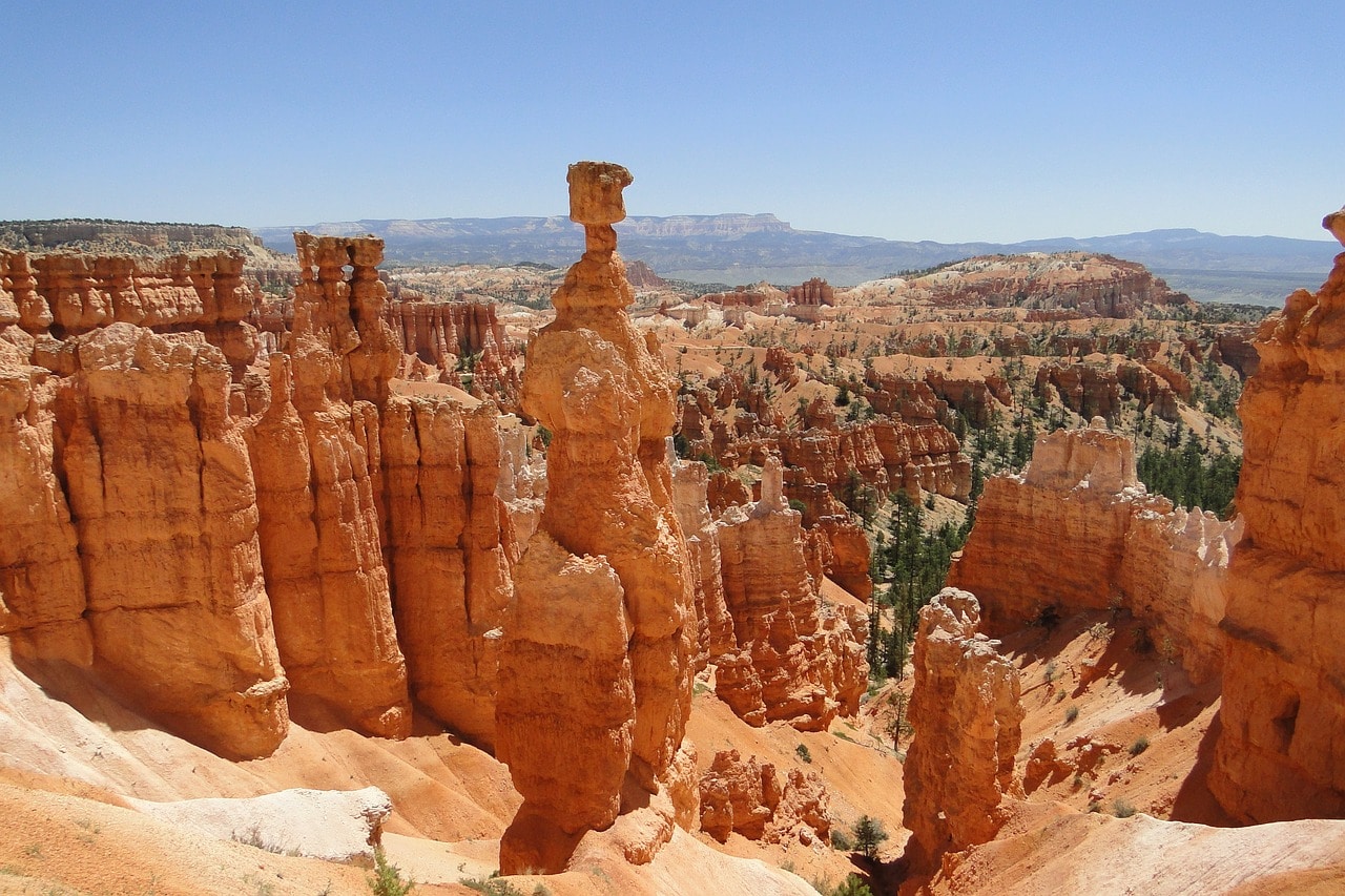
These rock pillars, also known as Fairy Chimneys or Earth Pyramids, fill the entire eastern fault line of the amphitheater-shaped canyons. Above the abyss, the popular Rim Trail mountain trail stretches between the park's vantage points. Over the chasm, a long road connects 13 viewpoints of the park.
Click here for all the information on a trip to Bryce Canyon…
How to explore Bryce Canyon National Park?
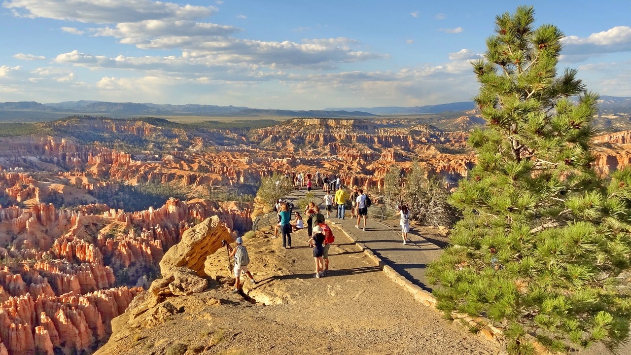
The trip in Bryce Canyon is relatively straightforward. It involves driving on Bryce Canyon Road (Highway 63) from Bryce Canyon City in the north to Rainbow Point in the south. The road runs above the cliff edge and provides access to 13 different viewing points along the ridge above the abyss.
Hiking trails connect the viewpoints, the main one being the Rim Trail, which is considered easy with no steep ascents or descents. From the rim, several great hiking paths descend at various difficulty levels (from moderate to hard), reaching some of the canyon's unique rock formations. A more adventurous way to explore the trails down the canyon is on horseback.
What is Bryce Canyon National Park?
Bryce Canyon National Park is one of the most unique landscapes in the United States. It's the second most popular park in the iconic cluster of parks in the southern part of Utah, alongside the popular Zion Park, located just a one and a half hour drive to the west.
- The park is located on the western part of the Paunsaugunt Plateau, a geological section of the so-called Colorado Plateau.
- The western edge of the plateau is characterized by sedimentary and sandstone rocks from different periods, built in layers and exposed by the canyon's formation.
- Bryce Canyon was formed by what is known as headward erosion, the flow of mountain streams and their descent in a waterfall, subsequently carving out the lower catchment areas in the rock from which the waterfall drops, creating a geological formation resembling an amphitheater.
- The erosion of water and wind in the sedimentary and sandstone layers created unique sculptures of spectacular stone columns, along the semicircle of the amphitheater. These sculpture columns are called Hoodoos.
- The largest of the semicircles in the western rock line of the plateau is the Bryce Amphitheater, which spans almost 20 kilometers and rises 200 meters.
- The amphitheater is named after Ebenezer Bryce, a Mormon settler who lived in the area.
- The amphitheater or Bryce Canyon and its surroundings were declared a national park in 1923 after several Mormon farms were built at the bottom.
The base for a trip to Bryce Canyon is the town of Bryce Canyon City, which serves as the logistical and hospitality center of this unique natural area. The park is less popular than the neighboring Zion Park, but some say that in terms of landscape formations, it's much more unique.
Dixie National Forest
Dixie National Forest offers a beautiful scenic drive along Highway 143, between Bryce Canyon City and Cedar City. From there, it's about an hour's drive to Springdale, the logistical hub and gateway to Zion National Park. The national forest area features stunning geological formations and several hiking trails.
Zion National Park
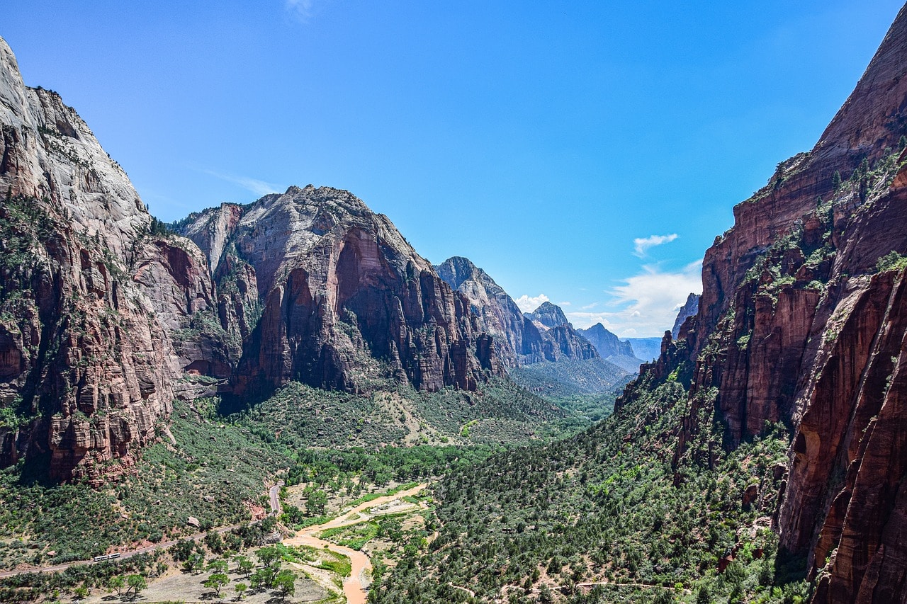
Zion National Park stretches along a breathtaking canyon of Navajo Sandstone, carved by the erosion of the Virgin River, a tributary of the Colorado. The main canyon of the park is perhaps the most popular natural space among the vast array of canyons and geological wonders of southern Utah, where an impossible concentration of stunning national parks in beauty. Within the canyon, there are hiking trails that have become legendary, breathtaking viewpoints from the heights and the ravine, and American order that allows even the most spoiled traveler to experience the wildest nature.
How do you travel in Zion Park?
A big part of the trip to Zion National Park takes place along the route of the Virgin River, a mountainous river that crosses Zion Canyon from north to south. Zion Canyon Road climbs up the river to the Temple of Sinawava. Along the road, there are options to descend to a wide range of attractions and hiking trails that climb upwards. North of the temple is the popular Riverside Walk, an accessible and easy trail, which continues into the Narrows, a challenging trail that includes climbing and walking along the creek itself.
Besides the canyon, there are several other attractions and hiking trails of various levels throughout the park. The northern area of Kolob Canyons is partially accessible by car. The town of Springdale, the southern entry gate to the park, is the logistical center and departure base for trips into the canyon.

What is Zion National Park?
Zion National Park is a vast nature reserve that includes the spectacular Zion Canyon to the south and the pristine Kolob Canyons to the north. The central part of the park is Zion Canyon, which was formed by the erosion of soft rock by the Virgin River. The river carves its way from the Big Springs area, high up on the peaks, and descends southwest to feed the Colorado River at the popular Lake Mead, just east of Las Vegas.
- The river cuts through the soft, sandy rock of Navajo Sandstone, the main geological feature of the Colorado Plateau region and the source of the stunning landscapes of the famous national parks in southern Utah and Arizona.
- The park is located on the unique geological and climatic seam of the Great Basin (the high plateau surrounded by the Sierra Nevada and Rocky Mountain ranges), the Colorado Plateau (the headwater basin of the Colorado River), and the Mojave Desert, the massive rain shadow desert east of the Sierra Nevada.
- The length of Zion Canyon, the main attraction of the park, is approximately 24 kilometers and its depth is about 800 meters
- The elevation at the southern part of the park is over 1100 meters, and the highest part is Horse Ranch Mountain peak, which rises above 2600 meters
- The elevation and topography significantly impact the park's extreme weather
Red Cliffs National Conservation Area
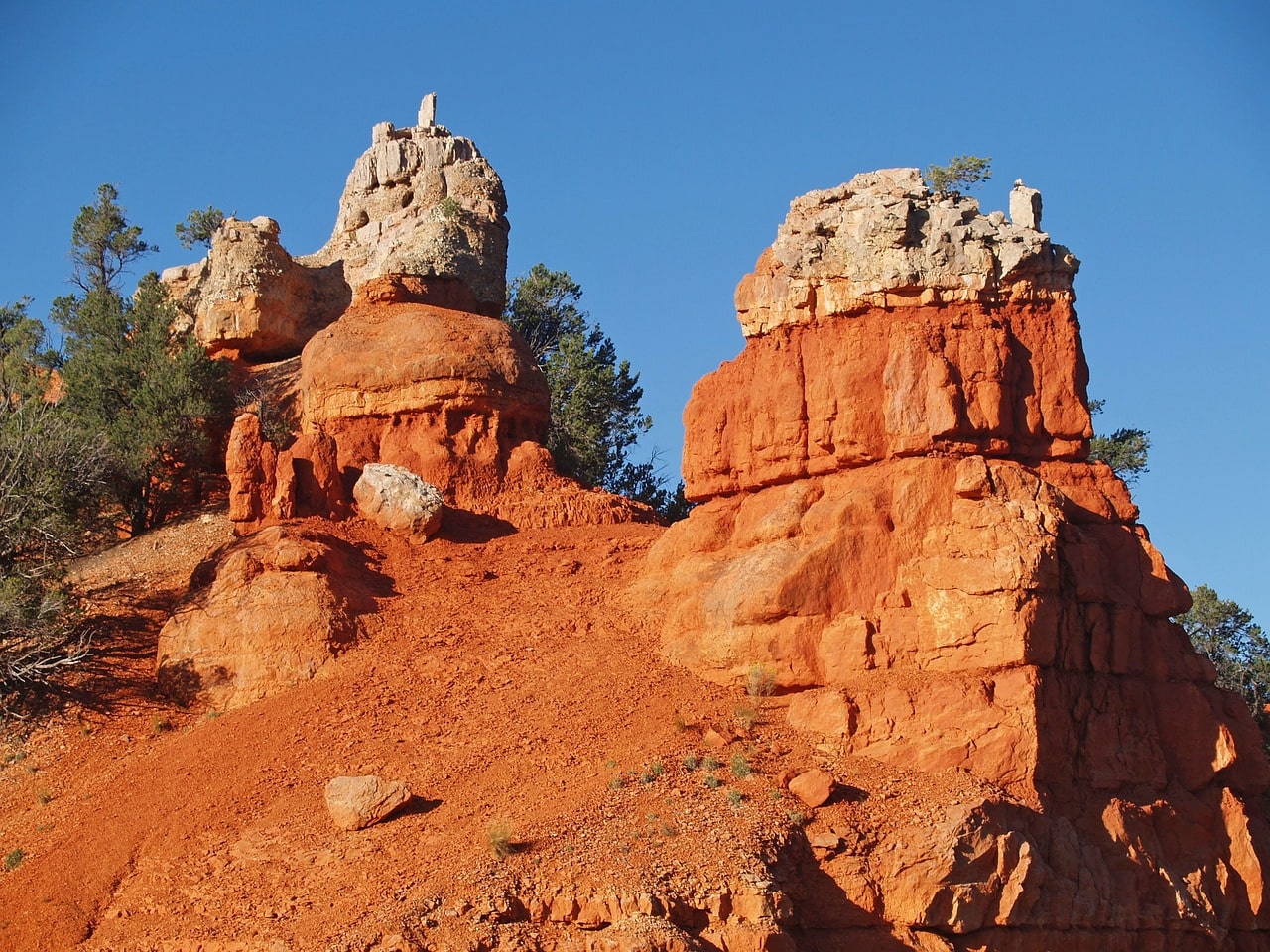
The Red Cliffs Nature Reserve is located in the mountains above the towns of Washington and St. George, along Highway 15. These towns are less than an hour's drive from Zion National Park. The reserve is primarily comprised of red Navajo sandstone cliffs. It also features arches, rock columns, and various pleasant attractions. Dirt roads lead from the towns towards the reserve, which are best traversed by off-road vehicles. The reserve offers several hiking trails of varying levels.
Coyote Buttes
From Saint George, you can continue south on Highway 15 and reach Las Vegas within an hour and fifty minutes' drive. You can also head east on Highway 389 or 89 towards the town of Page, the gateway to Glen Canyon. For those who really want to go all out, it's worth visiting Coyote Buttes, which is two hours from Page and two and a half hours from Saint George.
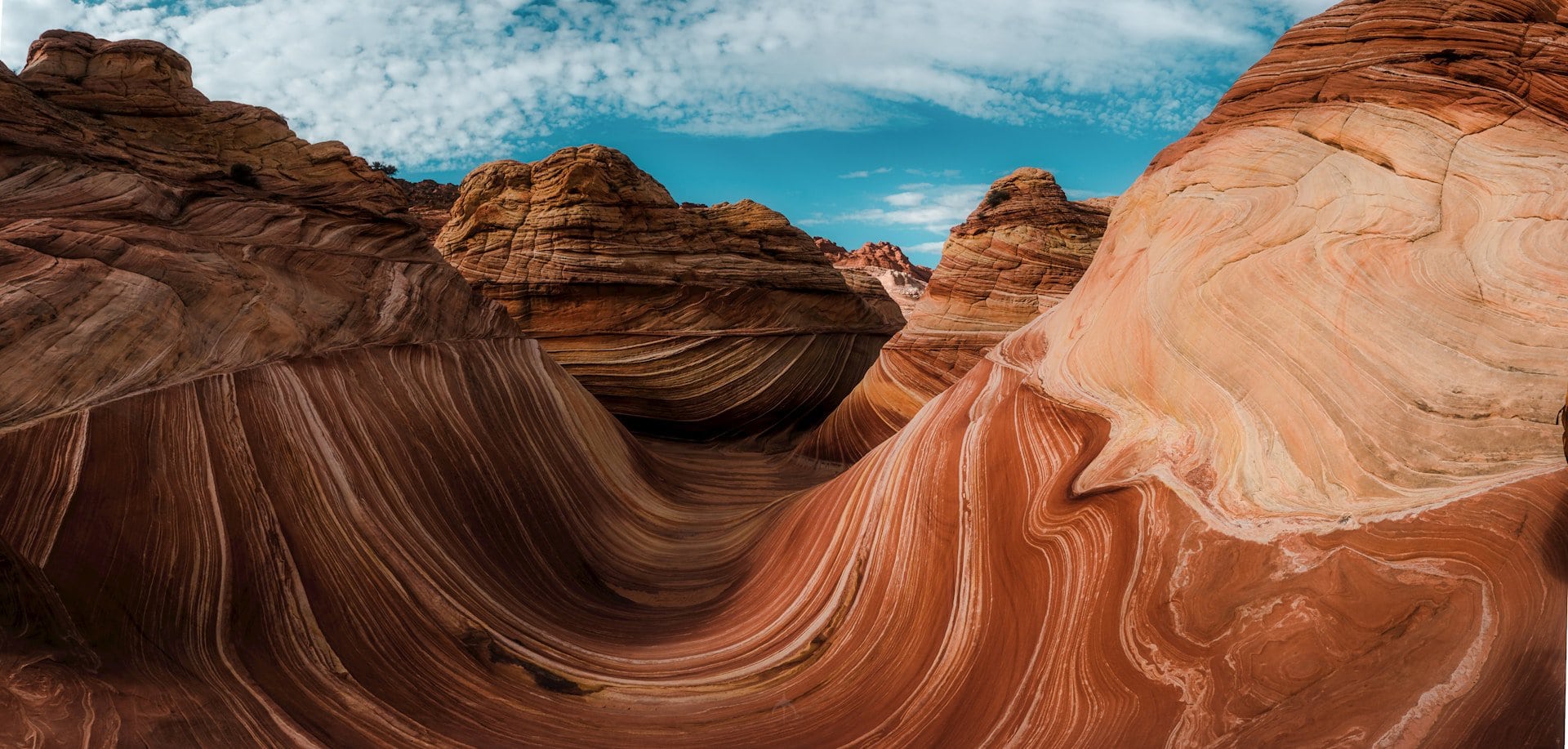
Coyote Buttes is a desert nature reserve featuring several stunning button hills and extraordinary rock formations. Besides the buttes, the place is mainly famous for the rock formation called The Wave, a remarkably smooth and carved channel. The reserve and the button hills are accessible via dirt roads (it's best with off-road vehicles), and the reserve has quite a few hiking trails of various levels.
Glen Canyon
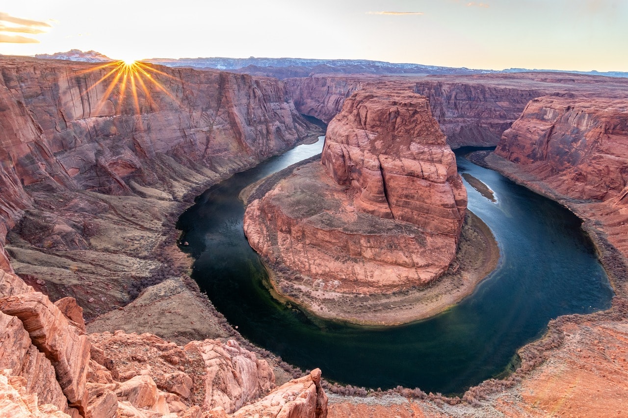
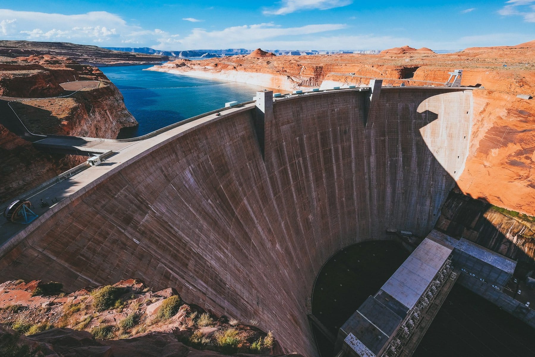
Glen Canyon is actually a massive human-made floodplain. The dam on the Colorado River, the Glen Canyon Dam, was completed in 1966 and led to the creation of Lake Powell, which flooded the lower parts of Glen Canyon. The dam is located next to the town of Page, right on the border between Utah and Arizona. It was founded for dam builders and workers and is now the logistical and commercial hub for trips to the canyon. Just south of the town is Horseshoe Bend, one of the most iconic viewpoints of the Colorado River.
The canyon is a very popular travel destination, with nearly two million visitors a year who mostly head to Wahweap, which is north of the dam on the lake area. There's a huge marina there from which boats and ships set sail on the lake. Sailing on the lake is a unique attraction, offering a view of the flooded areas that border the canyon's channel fragments. The lake was created from the confluence of the San Juan River with the Colorado River, and lake cruises also include the river areas.
The trip around the lake and canyon is mainly by boat, making breathtaking natural sites accessible, which are reached through hiking trails that start from docks along the lake shores. The canyon boasts several natural attractions such as the stunning Rainbow Bridge National Monument and the spectacular Reflection Canyon, among others.
Everything You Need to Know About Lodging in Towns Along the Colorado Plateau Parks
The Las Vegas Strip – All the Hotels and Attractions
The Las Vegas Strip is the grand central of tourism and leisure. It's the most intense place in the world for gambling and a generic name for an escapade with a hint of exciting nightlife. Gambling formed the foundation of the city's development as a tourist destination, but the Strip's hotels and resorts have evolved significantly since the lively days of Bugsy Siegel and Sin City.
Today, hotels offer unique vacation options with pools, spa facilities, indoor malls within the casinos, and a huge variety of entertainment options. The Strip hotels are the most free-spirited place in the world with options for drinking, dining, buffets, and everything imaginable for fun around the clock.
Click here for all the information on the Las Vegas Strip hotels…

Everything You Need to Know About Staying in Grand Canyon National Park
Accommodation options in Grand Canyon National Park generally fall into 4 categories:
- Staying inside the park at lodges in Grand Canyon Village, in RVs, or camping
- Excellent hotels and motels in Tusayan, just a fifteen-minute drive from Grand Canyon Village
- Motels at Grand Canyon Junction, a thirty-five-minute drive from Grand Canyon Village
- Accommodation in motels and hotels in towns and villages near the park entrances, mainly in Williams
The hotels and lodges within the park offer the Grand Canyon experience in the most spectacular way possible. Near the Grand Canyon Railway, there are several lodges like the Thunderbird Lodge, Kachina Lodge, and the El Tovar Hotel, a three-star hotel. The view from the hotel and lodge rooms gives you an insanely breathtaking canyon experience.
Staying in Tusayan or Grand Canyon Junction is the most budget-friendly and efficient option. The town's motels include well-known brands like IHG's Holiday Inn Express, a Best Western brand, and more.
Click here to check availability and prices in hotels and motels near the Grand Canyon Village…

Everything you need to know about lodging near Monument Valley
Since Monument Valley is located in a remote area, it's definitely worth considering finding accommodation during your trip to the valley. You can stay right near the valley or on the way towards Las Vegas or the city of Moab in Utah. A large portion of visitors to the park don't stay in the area; they visit the valley as part of their route between Moab and the Grand Canyon.
Accommodation near Monument Valley is roughly divided into two:
- Stay at lodges and motels close to the park or near the Goulding Village airstrip. Accommodation within the park is at the magnificent View Lodge, close to the visitor center
- Motels in nearby villages and towns along Highway 163 such as Bluff, Mexican Hat, or the relatively large Kayenta in Arizona. In the towns and villages, there are mostly private roadside hotels, some good and some less so
Click here to check availability and prices for roadside hotels near Monument Valley…
Accommodation in Moab
From Monument Valley, head north on Highway 191 into Utah and after a two and a half hours' drive, you'll arrive in Moab. The town of Moab is the logistical and urban hub for the national parks of southeastern Utah. Both parks, Arches and Canyonlands, are located right on the outskirts of the town.
The town's buildings are situated south of the Colorado River, with Highway 191 serving as the town's main street, lined with motels, restaurants, and shops. Around five thousand residents live in the town, almost all of whom are connected in one way or another to the national parks and the massive tourist influx that saturates the area throughout the year.
Lodging in Bryce Canyon National Park
Lodging in the Bryce Canyon area is roughly divided into two categories:
- Staying at park motels, those located in Bryce Canyon City
- Staying in the nearby town of Tropic, just a ten-minute drive from Bryce Canyon City
In Bryce Canyon City, there are several large motels serving as lodges, including two Best Westerns. This is the most popular lodging place in the park, featuring very large lodge hotels. The city also has restaurants, but generally, there isn't much to do beyond the park's operating hours.
Staying in Tropic offers classic American roadside lodging. Along the main street of the town, there's a line of motels that are often much more affordable than staying in Bryce Canyon City. On Main Street, you'll also find shops, restaurants, and everything you need for provisioning. But don't expect anything too lively.
Click here to check availability and prices for hotels in Bryce Canyon National Park…
Lodging in Zion National Park
Lodging options near Zion National Park:
- Accommodations in Springdale's Hotels and Motels – The town of Springdale is the main gateway to the park and also where the visitor center is located. Throughout the town, there are numerous hotels and motels ranging from one to three stars. The main street of the town – Zion Park Boulevard – is filled with accommodations, restaurants, shops, and everything you need for a park visit.
- Throughout the park itself, both in Zion Canyon and its other parts, there are several active lodges where you can spend the night. These lodges offer full hotel services and are of a very good standard. The official lodge in the park is the Zion National Park Lodge, located opposite the Emerald Pools.
- The most cost-effective motels and hotels in terms of price are found in the small towns outside the park, such as St. George and Washington on the I-15. The driving distance from these cities at the Utah-Nevada border to the park itself is about an hour.
Click here to find accommodations in the hotels of Springdale, Utah…